
Order Total (1 Item Items):
Shipping Destination:

Mitchell Augustus 1792 1868 Young (11 results)
Skip to main search results
Product Type
- All Product Types
- Books (11)
- Magazines & Periodicals
- Comics
- Sheet Music
- Art, Prints & Posters
- Photographs
- Maps
-
Manuscripts &
Paper Collectibles
Condition
Binding
Collectible Attributes
- First Edition
- Signed
- Dust Jacket
- Seller-Supplied Images
- Not Printed On Demand
Free Shipping
Seller Location
Seller Rating
-
Condition: As New. Unread book in perfect condition.
-
Condition: New.
-
Condition: New.
-

Condition: New.
-
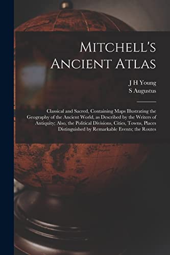
Mitchell's Ancient Atlas: Classical and Sacred, Containing Maps Illustrating the Geography of the Ancient World, as Described by the Writers of Antiqu
Published by Legare Street Press, 2022
ISBN 10: 1015588255ISBN 13: 9781015588257
Book
Condition: New.
-
Mitchell's Ancient Atlas: Classical and Sacred, Containing Maps Illustrating the Geography of the Ancient World, as Described by the Writers of Antiqu
Published by Legare Street Press, 2022
ISBN 10: 1015588255ISBN 13: 9781015588257
Book
Condition: As New. Unread book in perfect condition.
-

Mitchell's Traveller's Guide through the United States, Containing the Principal Cities, Towns, &c Alphabetically Arranged; Together with the Stage, Steam-Boat, Canal, and Rail-Road Routes, with the Distances, in Miles, from Place to Place.
Published by Philadelphia: Thomas, Cowperthwait & Co., [1845]., 1845
Folding engraved map (17 4/8 x 21 4/8 inches) showing the United States as far west as Indiana Territory, as far south as Florida with 8 insets of the Vicinity of Cincinnati; Vicinity of Albany; Vicinity of the Falls of Niagara; Vicinity of New York; Vicinity of Charleston; Vicinity of Baltimore and Washington; Vicinity of Philadelphia; and Vicinity of Boston, with original hand-colour in outline (very browned). 78-page guide. Original blind-embossed tan roan, lettered in gilt on upper cover. Provenance: Several canal routes through Ohio, Indiana, Pennsylvania, and New York shown in blue ink. First published in 1832, with accompanying text added in 1834, and continuously updated and enlarged. "Internal improvements coupled with the great Irish and German migrations beginning in 1827 led to the production of traveler's guides that depicted roads and their distances, steamboat and canal routes, and lengths of principal railroads. In 1832 Samuel Augustus Mitchell first issued his 'Traveller's Guide through the United States' and complimented it two years later with 'Tourist Pocket Maps' of the different states. These early works and their multitudinous progeny over the next fifty years laid the foundation for the road maps of today" (Schwartz & Ehrenberg, The Mapping of America, page 255).
-
Map of the States of Ohio, Indiana and Illinois with the Settled Part of Michigan.
Published by Philadelphia: S. Augustus Mitchell, 1837., 1837
Single sheet (17 x 21 inches to the neat-line, full margins). Letterpress census laid down on the front past-down. Fine folding engraved map with insets of the "Lead Region East of the Mississippi River"; "Falls of Ohio"; "Vicinity of Cincinnati"; and "Vicinity of Detroit", with original hand-colour in full (laid down on archival tissue, one or two small losses, some staining). Original black roan, gilt (a bit rubbed). Provenance: some canal routes marked in red and blue pen. First issued in 1834, and with some changes from that issue: Lake Michigan has been redrawn, the addition of new counties in Indiana is notes, such as Porter, Newton, and Jasper, etc.). Iowa did not become a territory until 1838 and a state until 1844, and is labeled here as Missouri and Wisconsin Territory. Interestingly this map shows the controversial Dubuque lead mining region, including the site of Julien Dubuque's grave. Between 1796, when this grant was confirmed by the Spanish governor of Louisiana, and his death in 1810, Dubuque had succeeded in establishing a monopoly controlling the smelting and shipping of lead from the region, known as the "Mines of Spain". Unable to sustain a working relationship with the local Ioway Indians Dubuque's creditors who succeeded to his rights abandoned the enterprise, and lead-mining rights in Iowa remained in a legal turmoil that lasted until 1853, when the United States Supreme Court issued a landmark decision on the ownership of the Dubuque area mines, disallowing claims based on Julien Dubuque's Spanish land grants.
-
Map of the States of Ohio, Indiana and Illinois with the Settled Part of Michigan.
Published by Philadelphia: S. Augustus Mitchell, 1836., 1836
Engraved folding pocket map (17 4/8 x 22 2/8 inches to the neat-line, full margins). Letterpress census laid down on the front past-down. Fine folding engraved map with insets of the "Lead Region East of the Mississippi River"; "Falls of Ohio"; "Vicinity of Cincinnati"; and "Vicinity of Detroit", with original hand-colour in full (some spotting and offseting). Contemporary publisher's cherry roan, gilt (a bit rubbed). First issued in 1834, and with some changes from that issue: Lake Michigan has been redrawn, the addition of new counties in Indiana is notes, such as Porter, Newton, and Jasper, etc.). Iowa did not become a territory until 1838 and a state until 1844, and is labeled here as Missouri and Wisconsin Territory. Interestingly this map shows the controversial Dubuque lead mining region, including the site of Julien Dubuque's grave. Between 1796, when this grant was confirmed by the Spanish governor of Louisiana, and his death in 1810, Dubuque had succeeded in establishing a monopoly controlling the smelting and shipping of lead from the region, known as the "Mines of Spain". Unable to sustain a working relationship with the local Ioway Indians Dubuque's creditors who succeeded to his rights abandoned the enterprise, and lead-mining rights in Iowa remained in a legal turmoil that lasted until 1853, when the United States Supreme Court issued a landmark decision on the ownership of the Dubuque area mines, disallowing claims based on Julien Dubuque's Spanish land grants.
-
Map of the States of Ohio, Indiana and Illinois with the Settled Part of Michigan.
Published by Philadelphia: S. Augustus Mitchell, 1835., 1835
Engraved folding pocket map (17 4/8 x 21 6/8 inches to the neat-line, full margins). Letterpress census laid down on the front past-down. Fine folding engraved map with insets of the "Lead Region East of the Mississippi River"; "Falls of Ohio"; "Vicinity of Cincinnati"; and "Vicinity of Detroit", with original hand-colour in full (some browing and short separations at folds). Contemporary publisher's red roan, gilt (scuffed). First issued in 1834, and with some changes from that issue: Lake Michigan has been redrawn, the addition of new counties in Indiana is notes, such as Porter, Newton, and Jasper, etc.). Iowa did not become a territory until 1838 and a state until 1844, and is labeled here as Missouri and Wisconsin Territory. Interestingly this map shows the controversial Dubuque lead mining region, including the site of Julien Dubuque's grave. Between 1796, when this grant was confirmed by the Spanish governor of Louisiana, and his death in 1810, Dubuque had succeeded in establishing a monopoly controlling the smelting and shipping of lead from the region, known as the "Mines of Spain". Unable to sustain a working relationship with the local Ioway Indians Dubuque's creditors who succeeded to his rights abandoned the enterprise, and lead-mining rights in Iowa remained in a legal turmoil that lasted until 1853, when the United States Supreme Court issued a landmark decision on the ownership of the Dubuque area mines, disallowing claims based on Julien Dubuque's Spanish land grants.
-
The Tourists Pocket map of Pennsylvania Exhibiting Its Internal Improvements, Road Distances, &c.
Published by Philadelphia: S. Augustus Mitchell, 1833., 1833
Single sheet (13 x 14 6/8 inches to the neat-line, full margins). Letterpress Pennsylvania Census for 1830 laid-down on the front paste-down, Mitchell's imprint on the back paste-down. Fine engraved map of Pennsylvania, with insets of the Lehigh and Schuylkill Coal Regions, the Vicinity of Philadelphia, and a profile of Pennsylvania Canal, with original hand-colour in full (one or two separations at folds). Original blue roan, gilt (expertly rebacked to style). First published by Mitchell, one of America's pre-eminent cartographers, in 1831 in his re-issue of Finley's "New American Atlas" but with considerable additions and improvements, on which he collaborated with Young. Mitchell and Young continued to work together for decades, including on this series of pocket maps, of which this is one of the earliest.
